
|
|
California Earthquake Faults is an iPhone/iPad app that gives you 5 views of California faults:
|
|
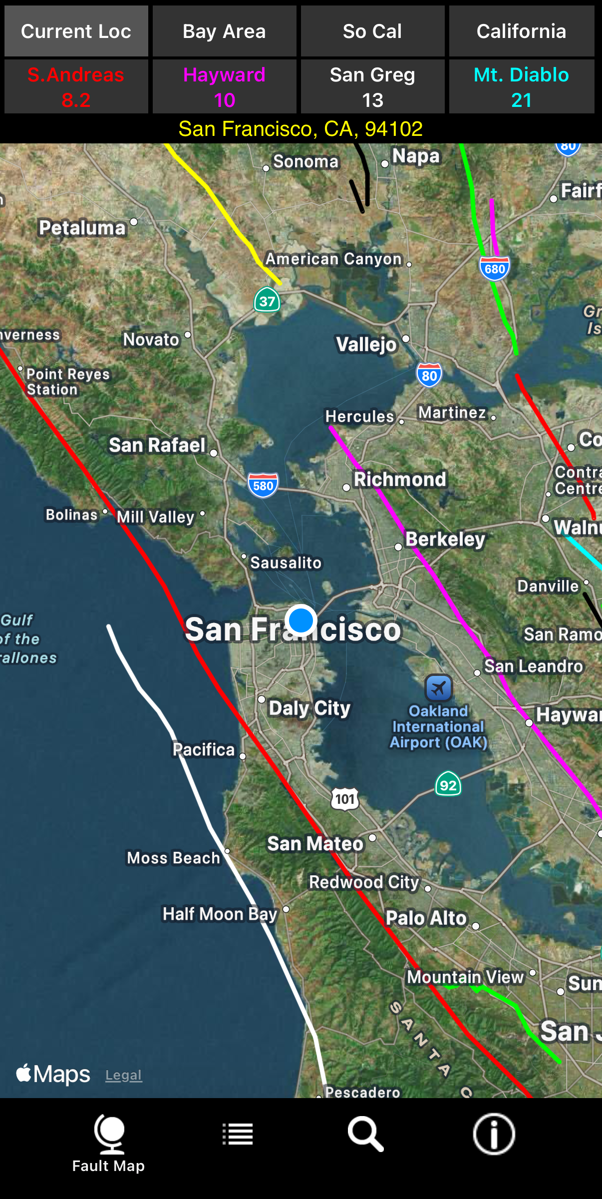
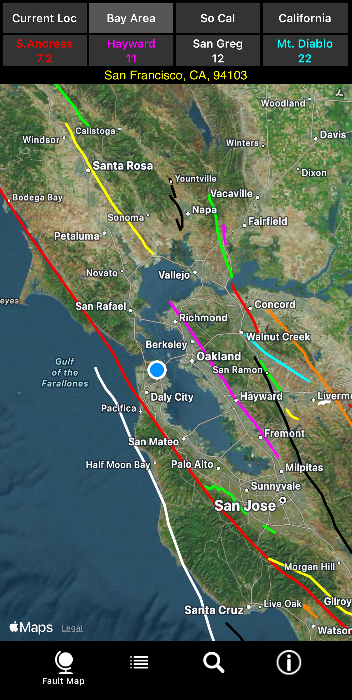
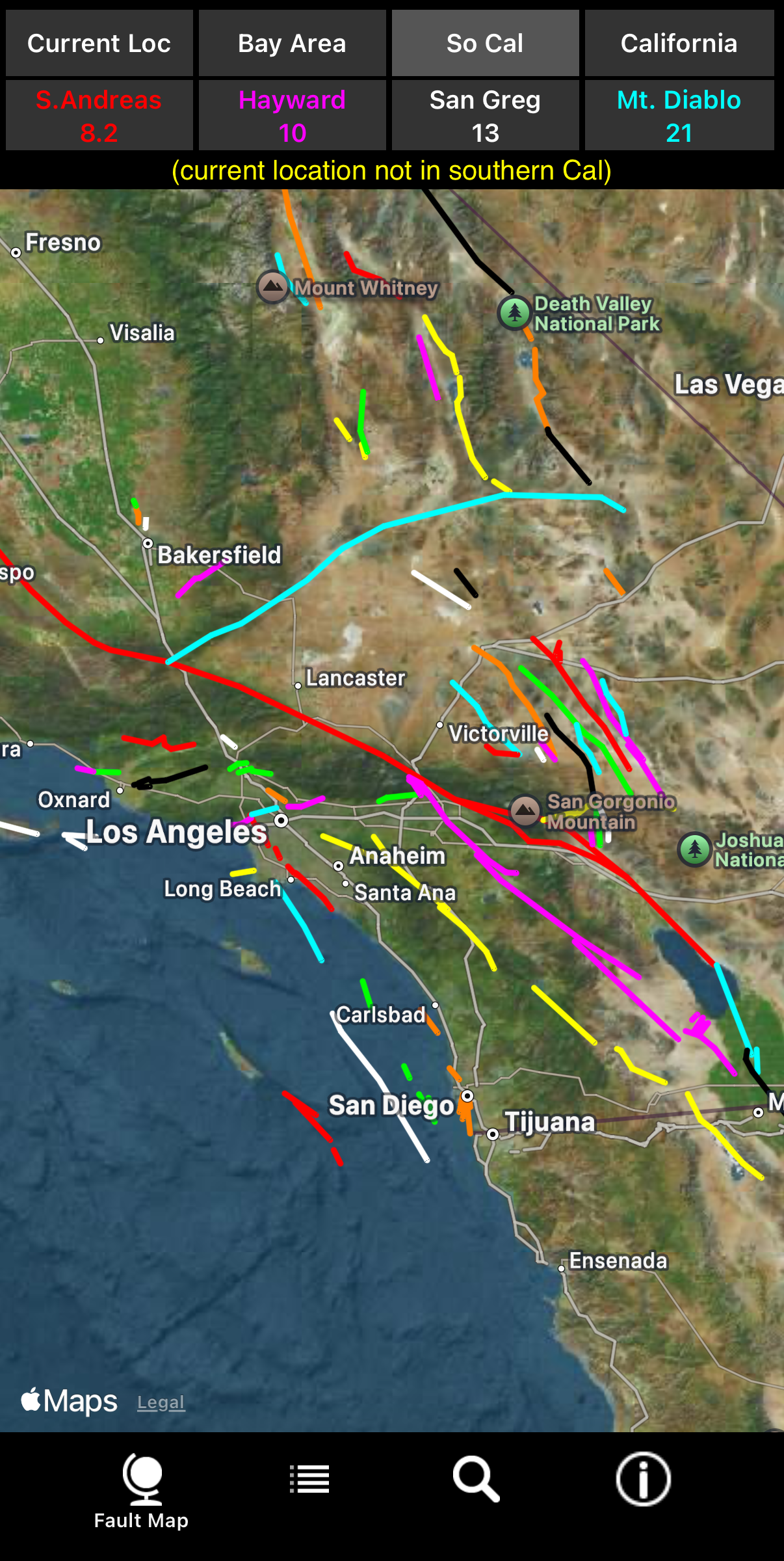
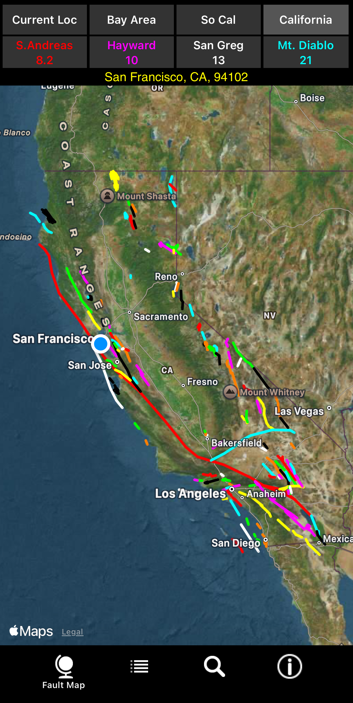
Tapping the first row of buttons shows the first 4 regional views. The second row of buttons shows distances to the closest 4 faults. If you tap them, you'll be zoomed into a closer view of your current location and the selected fault.
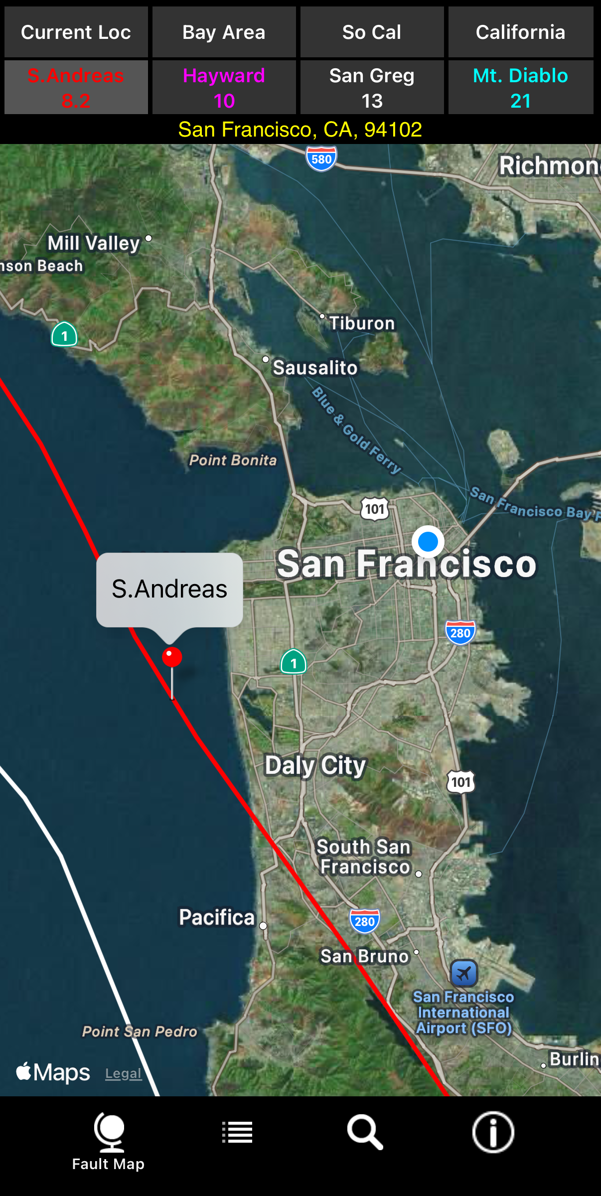
The first iPhone screenshot shows your current location as a blue dot surrounded by a white boundary
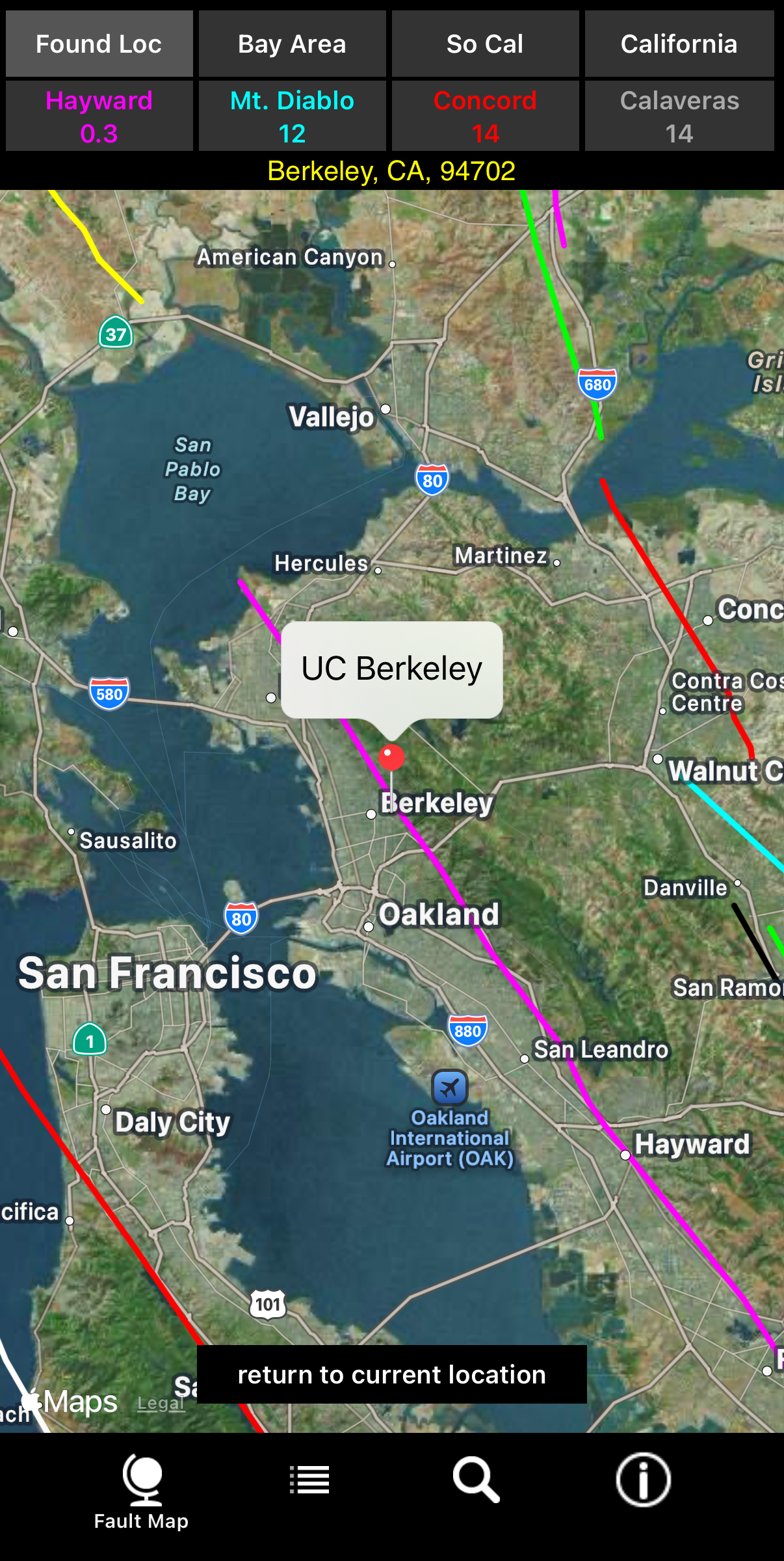
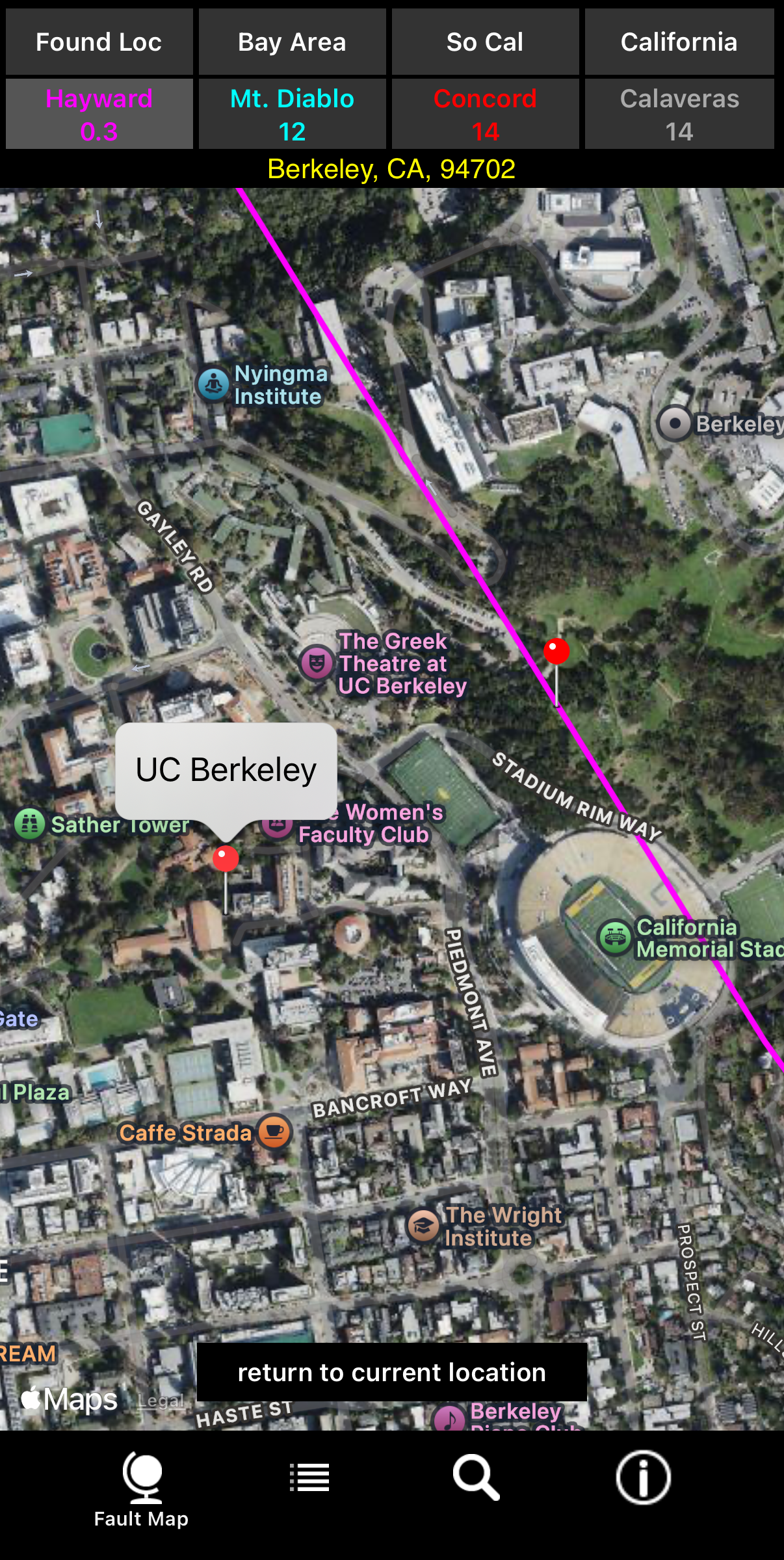
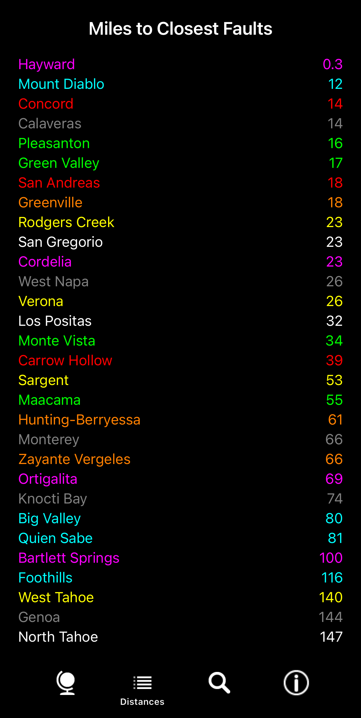
( You can use the Find button at the bottom of the screen to specify a location. The sixth, seventh and eigth screenshots show finding UC Berkeley, zooming into the Hayward fault and distances. |
|
The vast majority of California faults the USGS classifies as "Historic" (active in the last 150 years) and "Holocene to Latest Pleistocene" (active in the last 15,000 years) are shown. That includes over 115 faults and 248 fault lines (some faults have multiple fault lines). It does not include all faults or faults classified as "Quaternary" (15,000 to 1,600,000 years) by the USGS. Tapping a fault will display its name. This app does not show the location of recent or historic earthquakes. Many other apps do that. It simply shows the approximate locations of faults in California and approximate distances to your current location or a location you specify. This app is available on the (App Store) for $1.99. It requires IOS 16.0 or later, an active WiFi or cellular services (preferably both) and Location Services enabled for your device and this app, as well as Precise Location for this app. It should work on iPhones and iPads released in the last 6 to 7 years. Feel free to contact us at calfaults@gmail.com. |
|
Current Location
|
Bay Area
|
Southern California
|
California
|
||||
 |
 |
 |
 |
|
Zoom into San Andreas fault
|
Find UC Berkeley
|
Zoom into Hayward fault
|
Distances from UC Berkeley
|
||||
 |
 |
 |
 |
|
Copyright 2012-2026 D.Pasadis. All rights reserved. |