
|
|
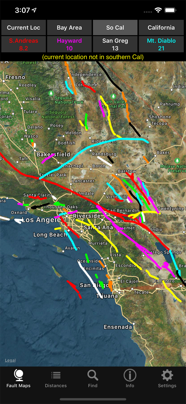
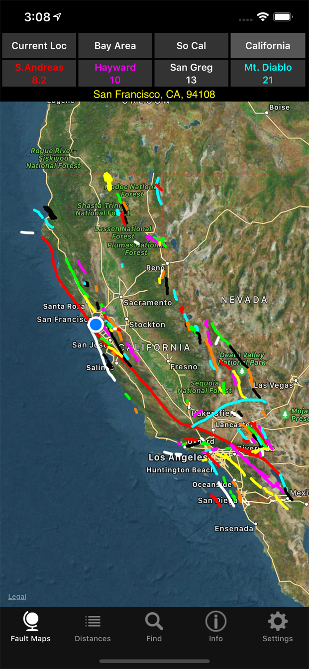
California Earthquake Faults is an iPhone/iPad app that shows your current location or a location you specify, the closest faults to that location and approximate distances to those faults. It also shows maps of faults in the San Francisco Bay Area, southern California and the entire state, along with distances to those faults. Tapping a fault will display its name. |
|
It shows the vast majority of California faults the USGS classifies as "Historic" (active in the last 150 years) and "Holocene to Latest Pleistocene" (active in the last 15,000 years). That includes over 115 faults and 248 fault lines (some faults have multiple fault lines). It does not include all faults or faults classified as "Quaternary" (15,000 to 1,600,000 years) by the USGS. All fault lines and distances are approximate. The current version is available on the App Store (here) for $1.99. It requires IOS 16.0 or later and an active WiFi or cellular services (preferably both) that allow secure connections to the Internet. Some public WiFi networks do not allow secure connections. In this case, you can turn off WiFi and use a cellular network. It should work on iPhones and iPads released in the last 6-7 years. If it doesn't work on your iPhone or iPad, please contact us at calfaults@gmail.com. |
|
Current Location
|
San Francisco Bay Area
|
Southern California
|
California
|
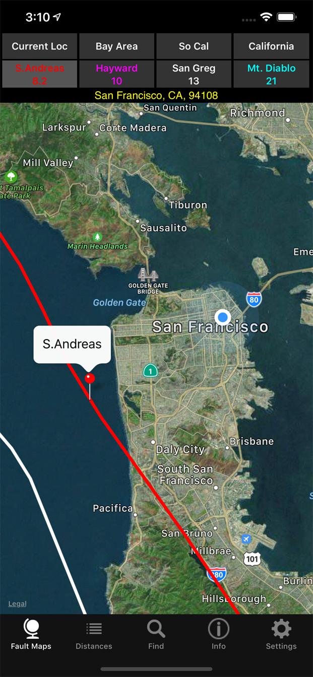
Zoom into S.Andreas fault
|
|||||

|

|
|
|
|